Maps & Favorites
Overview
Reference material for the Maps & Favorites tool/feature in ATAK, sourced from the official ATAK 5.8 Software User Manual (chapter 8, "Maps and Favorites").
Manual Reference
Select the Maps & Favorites icon to list the imagery loaded in the application.

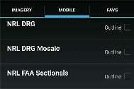

The following categories are shown: Imagery, Mobile and Favorites (FAVS). Select Online/Local on the Mobile tab to toggle between using an online map source or locally stored map layers over a desired area. Tap on the FAVS tab to review a previously saved view or to add the current view.
Saving a Map Layer
To save a local copy of a map layer, choose the Mobile tab and toggle to Online. Select the right arrow to expand the Map Source option, then tap Select Area to define a region of interest. A prompt will appear presenting four options for map area selection: Rectangle, Free Form, Lasso or Map Select. The Rectangle option uses the top left and lower right corners to denote the area to be downloaded. The Free Form option provides the ability to create a custom area to be downloaded by tapping different points on the map until the shape is complete or the end button is selected. Lasso provides the ability to draw a lasso around a specific area on the map to be downloaded.
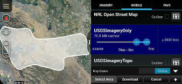
Map Select allows for an already existing shape or route to be selected as the area intended for download. If a route is chosen, a prompt will be provided to enter a Route Download Range. This is the distance from the route that will be downloaded.
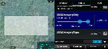
Drag the map source slider end points to select the resolution for the tileset being downloaded. The number of tiles to be downloaded will be indicated, with the current download limit set at 850,000 tiles. Select the Download button to begin the download process. If the selected tiles are close to the threshold, a warning message will appear before the download begins.
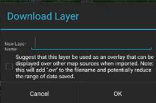
A new tileset can be created, the tiles being downloaded can be added to an existing one, or the download can be created as an Overlay file to layer on top of an existing map layer. Enter the name to be applied to the selected layers and select OK. A status indicator will appear to show the download progress. A download-in-process can be canceled by selecting the Cancel button. Online and Local map layers can be toggled as needed. When Local is selected, a listing of the downloaded imagery layers in the current map interface appears. The local layers are listed in order beginning with the area closest to the map center. Select the Outline checkbox to toggle the outline layers on or off. When the user selects a layer from the list, map source data corresponding to that downloaded layer will be used as the source for map data.
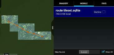
Imagery can be imported via the Import Manager tool or placed directly into the atak folder structure for use by the application. For instructions on which subfolder a specific file type should be placed, refer to the information found in Settings > Support >ATAK Documents > ATAK Dataset Instructions. All imported imagery will be listed under the Imagery tab and function the same as the Mobile tab.

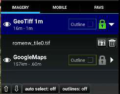
Imported imagery and downloaded map sets can be shared with other users or deleted from the Imagery tab. Selecting the Imagery tab displays the types of imagery available. Expanding the category lists the individual files. From here, the user can Send the file to other users or delete it.
If Show All is checked, all available layers are listed. Otherwise, only layers that are visible in the current map view will be listed. Imagery based map products (e.g., MrSID, GeoTIFF, NITF) that are placed in the atak/imagery folder will appear under the Imagery tab when ATAK is restarted. To view the list of supported products, select Settings > Support > ATAK Documents > ATAK Dataset Instructions.
Bookmarking a Location
To save the current view and displayed imagery, select the FAVS tab and tap Add Current View. A prompt will appear to name the view, which will be saved along with its coordinates and the map source being used. Selecting a view in the FAVS listing will pan the map to that location and transition to the map source used in the saved view.
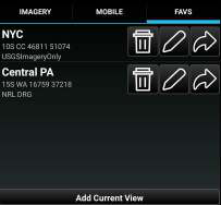
Saved Favorite views can be sent to other TAK users by selecting the Send option.
Web Feature Service (WFS) Support
WFS imagery is supported and can be ingested in several different ways. Existing WFS XML configuration files can be imported through the Import Manager. The files can also be placed into the atak/WFS directory manually.
Additionally, WFS Imagery can be added by selecting the right arrow at the bottom of the Maps & Favorites Mobile tab to expand the Map Source option, selecting + and then entering a WFS Imagery Service URL. After querying the service, a list of available imagery sets will be presented. Select the required services for import and then select OK.
Source
ATAK 5.8 Software User Manual, 07 July 2026 (Unclassified), pages 33–35.